Contact Us

Use the form on the right to contact us.

You can edit the text in this area, and change where the contact form on the right submits to, by entering edit mode using the modes on the bottom right. 

PO Box 3201
Martinsville, VA 24115
United States

Stephen H. Provost is an author of paranormal adventures and historical non-fiction. “Memortality” is his debut novel on Pace Press, set for release Feb. 1, 2017.

An editor and columnist with more than 30 years of experience as a journalist, he has written on subjects as diverse as history, religion, politics and language and has served as an editor for fiction and non-fiction projects. His book “Fresno Growing Up,” a history of Fresno, California, during the postwar years, is available on Craven Street Books. His next non-fiction work, “Highway 99: The History of California’s Main Street,” is scheduled for release in June.

For the past two years, the editor has served as managing editor for an award-winning weekly, The Cambrian, and is also a columnist for The Tribune in San Luis Obispo.

He lives on the California coast with his wife, stepson and cats Tyrion Fluffybutt and Allie Twinkletail.

at Petunia's b 11-25-17.jpg

On Writing

Filtering by Tag: Americana

Roanoke book kicks off series on 20th century American cities

Stephen H. Provost

Do you remember when Dr. J played in Roanoke? When Santa's train stopped at the Miller & Rhoads Department Store downtown? When a native son starred in one of the biggest holiday movie classics of all time? Did you know that, once upon a time, Roanoke was home to the state's biggest football stadium and its first indoor mall? Whether you answered, "I didn't know that," or whether you just want to be reminded, that’s the kind of information you’ll find in Roanoke Century.

Read More

Recommended reading for highway history buffs

Stephen H. Provost

I’ve been researching America’s highways for nearly four years now, traveling more than 10,000 miles in my search for history.

When I’m not on the road, I spend hours combing through newspaper files, online articles and books for sources for the most interesting stories.

Many of the books published on historic highways — especially Route 66 — are travel guides, but a few offer extensive information on the history behind the roads, and those are the ones I’m spotlighting here. Titles are arranged alphabetically.

America's First Highways.jpg

America’s First Highways

Stephen H. Provost

Dragon Crown Books, 2020

Paperback, 290 pages, 8 x 10 inches

I set out to write this book after discovering I couldn’t find a single volume that examined the auto trails movement as a whole. There were a few books (some of which are on this list) that focused on individual trails, but I came up empty looking for any comprehensive work on these privately funded roads that preceded the federal highway system.

My research took several turns and resulted in two-part story. Part One looks at what led up to the trails: 18th-century stagecoach routes, the railroads, the Good Roads movement and early automakers. Part Two examines the trails themselves, with full chapters on the Lincoln and Dixie highways, along with extensive sections on the Jefferson and Lee highways, the Yellowstone and Ozark trails, among others.

There are stories of the “great race” from Paris to New York, the old plank road east of San Diego, Dwight Eisenhower’s Army trek over the Lincoln Highway and the auto camps that lined the early roads.

America’s First Highways includes more than 200 photos, some by the author but many vintage images from university and government archives. Pick this one up for a detailed and enjoyable overview of the auto trails phenomenon. It’s the second installment in my America’s Historic Highways series, a companion to Yesterday’s Highways (see below).

American Highway.jpg

The American Highway

William Kaszynski

McFarland & Company, 2000

Hardcover or paperback, 237 pages, 8 x 11 inches

A very good overview with lots of black-and-white illustrations, Kaszynski’s book is divided chronologically, with sections covering “The Early Days” (1900-1919), “The First Generation” (1920-1945), “The Golden Age” (1946-1969) and “The Interstate Era” (1970-2000). There’s a good, though short, section on auto trails that follows a brief overview covering the history of roads.

Another plus: Each of several major gasoline chains and roadside eateries gets its own short section, and there’s a good section on motels, too. The photo captions are sometimes a bit long, but they pack in some good information that augments what’s in the text.

The paperback is $39.95, but it’s also available for less on the secondary market, where you can find it in hardcover.

car culture.JPG

The Big Book of Car Culture

Jim Hinckley and Jon G. Robinson

Motorbooks, 2005

Paperback, 320 pages, 8 x 11 inches

This is a glossy-paged book packed with photos and brief articles on a variety of subjects arranged in six sections:

  • Only Twenty Miles to ...

  • Safety, Comfort and Style

  • The Ride

  • The Culture of the Road

  • Gasoline Alley

  • The Open Road

This isn’t the book to get if you want a comprehensive look at any aspect of the highway, but if you want a grab bag of diverse topics ranging from gas pumps to license plates, from the Lincoln Tunnel to the Las Vegas Strip, this is a breezy, fun read. None of the articles is particularly long, and most don’t go into much depth, but there are lots of illustrations — with color throughout — fun bits of trivia on the expected and the unexpected alike.

Dixie.JPG

Dixie Highway: Road Building and the Making of the Modern South, 1900-1930

Tammy Ingram

University of North Carolina Press, 2014

Hardcover, paperback or ebook; 272 pages, 6 x 9 inches

This very readable, yet information-packed book is divided into five chapters:

  • Building a Good Roads Movement, 1900-1913

  • The Road to Dixie, 1914-1916

  • Roads at War, 1917-1919

  • Modern Highways and Chain Gang Labor, 1919-1924

  • Paved with Politics: Business and Bureaucracy in Georgia, 1924-1927

Of them, I found the first two chapters the most fascinating, and the final chapter the least so. Of particular interest to me was information on how the highway routes were chosen, Carl Fisher’s role and the fights among various towns for a place on the highway. The sorry state of roads in the South, along with the role of World War I and chain-gang labor in improving Southern highways are also examined.

The research is thorough and the writer’s tone is conversational. The text is illustrated by a few photos, old advertisements and postcards. Several maps are also included — and particularly useful.

This is probably the definitive work on the Dixie Highway, a road that doesn’t get nearly as much attention as it deserves for the role it played in developing our highway system — and our nation.

Gas Station.JPG

Gas, Food, Lodging

This trilogy by John A. Jakle and Keith A. Sculle examines, in turn, service stations, roadside eateries and motels/inns. If you’re interested in American road culture, I challenge you to find more information in one place on any of these subjects.  

The three I’ve read in the authors’ Gas, Food, Lodging series have all been excellent, and I can recommend all three. They’re a little more academic than some books out there, which makes sense because the authors are both professors: Jakle specializes in geography and landscape architecture at the University of Illinois at Urbana-Champaign, while Sculle teaches history at the University of Illinois at Sprinfield. Each volume is packed with more information on chains and trends, along with statistical information, than you’ll find most places:

The Gas Station in America

Johns Hopkins University Press, 1994

Hardcover or paperback, 288 pages, 7 x 9.5 inches

The Motel in America

Johns Hopkins University Press, 1996

Hardcover or paperback, 408 pages, 7.5 x 10.5 inches

Fast Food: Roadside Restaurants in the Automobile Age

Johns Hopkins University Press, 1999

Hardcover or paperback, 416 pages, 7 x 11 inches

Highway 99.jpg

Highway 99: The History of California’s Main Street

Stephen H. Provost

Craven Street Books, 2017

Paperback or ebook, 233 pages, 8.5 x 10 inches

I set out to write the definitive history of U.S. Highway 99 in California and drove the length of the road, from the Mexican border to Yreka, taking photos, doing interviews and collecting information. I grew up along the highway, riding with my parents from Fresno to Orange County and back again several times a year and I wanted to preserve some of the memories I had — and find out more about California’s north-south version of Route 66.

I walked the cracked concrete on the Old Ridge Route between Bakersfield and L.A. I hiked out to the ruins of San Francisquito Dam. I drove Golden State Boulevard and San Fernando Road, old alignments of the modern highway.

I researched scores of news articles, books and other sources to create a three-dimensional portrait of the highway in two parts. The first tells the story of the road’s history, complete with the disasters that altered the shape of the road and the Dust Bowl migrants who traveled it. Gas stations, coffee shops and motels get full chapters. Then, the second part provides a tour of the highway, from south to north, stopping briefly in each town along the way.

The first book in the California’s Historic Highways series, this glossy-paged tome includes a section of color photos by the author. The text throughout is illustrated by historical and modern images.

Hwy101cover.jpg

Highway 101: The History of El Camino Real

Stephen H. Provost

Craven Street Books, 2020

Paperback or ebook, 270 pages, 9 x 10 inches

The second book in the California’s Historic Highways series follows much the same format as Highway 99. Part I tells the story of Highway 101 in California, from its origins as a wagon road connecting the Spanish missions to its new era as a federal highway. Part II offers the reader a literary road trip with stops along the coast in Carlsbad, at the Hollywood Bowl in Los Angeles, the eclectic and eccentric Madonna Inn in San Luis Obispo, the Golden Gate Bridge and the majestic redwood along the Avenue of the Giants.

There’s even a section about the Pacific Coast Highway, State Route 1, which parallels and sometimes joins 101 as it meanders up the coast. You’ll find out about “muffler men,” Disneyland and the short-lived Pacific Ocean Park marine amusement park in Santa Monica. You’ll learn about the fancy gas station that was targeted in the only Japanese strike to hit the U.S. mainland during World War II.

Like Highway 99, this companion volume comes complete with a central color well of vibrant photos from the author himself (yeah, that’s me).

Capture.JPG

Highway History

Richard F. Weingroff

U.S. Department of Transportation, Federal Highway Administration — fhwa.dot.gov

Online

This isn’t a book, but it might as well be. In fact, there’s probably enough material here for several books, and the best part is, it’s free.

Richard F. Weingroff has written numerous articles about highway history, all of which are available for viewing on the site. Weingroff is information liaison specialist for the FHA/DOT and became the agency’s “unofficial  historian” in the 1980s. He’s written articles on the Jefferson Highway, the Lincoln Highway, and several other auto trails; the interstate highway system; President Eisenhower’s role in improving the nation’s highways, and dozens of other topics.

Jefferson.JPG

The Jefferson Highway: Blazing the Way from Winnipeg to New Orleans

Lyell D. Henry Jr.

University of Iowa Press, 2016

Paperback or ebook, 220 pages, 6 x 9 inches

Henry’s book is to the Jefferson Highway what Ingram’s work is to the Dixie, with a heavier dose of historical photos, which is welcome. Did you know the guy behind this particular road was also the publisher of Better Homes & Gardens? Or that the Jefferson Highway was born in Iowa? You may never have heard of the highway at all, and if you haven’t, you’ll find a host of interesting information in Henry’s book.

The author is a professor of political science, but he writes in a conversational and easy-to-read style. The third and fourth chapters, which cover how the highway was built and marked (with signs) contained the most interesting info, at least to me, with the latter chronicling the decline and eventual fall of the road as numbered federal highways took its place.

The book is divided into two parts. The first five chapters delve into the history of the highway, which, for the uninitiated, ran from Winnipeg up in Manitoba, Canada, down to New Orleans. The last three chapters focus on “Looking for the Highway,” which is great if you want to take a tour. The section also includes photos of notable roadside sites and sights.

Ridge Route.JPG

Ridge Route: The Road that United California

Harrison Irving Scott

Independently published, 2015 (updated edition)

Hardcover, 410 pages, 6 x 9 inches

This book was a labor of love, and it shows. Scott has devoted decades to preserving the concrete pavement across the Tehachapi Mountains that first united Northern and Southern California, starting in 1915. The Old Ridge Route is a relatively short road (compared to, say, Route 66) that served motorists for a brief period of time — it was bypassed less than two decades after the first concrete pavement was laid down. Is there enough information on such a road to fill an entire book? Rest assured, there is, and Scott does a great job of covering all the bases.

Scott says in his preface that eight years of research went into this book, and it shows. A full 25 chapters cover everything from road construction to roadside inns, with sections on the tragic yet intriguing Saint Francis Dam disaster and a crazy winter snowstorm in 1922.

At $39.95, this book is a bit pricier than some, but its glossy pages and plethora of fine historical photos make it worth the investment for any highway buff.

66.jpg

Route 66: The Highway and Its People

Susan Croce Kelly (text) and Quinta Scott (photos)

University of Oklahoma Press, 1988

Hardcover or paperback, 210 pages, 9 x 10.5 inches

This is a hybrid book, featuring lots of great photos and plenty of illuminating text. It includes some great historical background on the formation of Route 66, along with interviews with many who lived along the road — a perspective you don’t find in most books of this type. Chapters focus on how the road was conceived and paved, and the impact of the Dust Bowl and World War II, among other subjects.

The main text is sprinkled with photos, but there’s also a 61-page glossy section at the heart of the book that’s just photos. They’re all in black and white, which adds to the nostalgic, wistful and sometimes almost ghostly feel of a highway that’s disappearing, piece by piece. There are scores, perhaps even hundreds of books out there on Route 66. If you have to choose just one, get this one.

Ribbon.JPG

That Ribbon of Highway

Jill Livingston (text) and Kathryn Golden Maloof (photos)

Living Gold Press, 2010

Paperback in three volumes, 288, 288 and 252 pages, 8 x 6 inches

A solid overview of Highway 99 in three volumes, this series offers plenty of photos and some interesting facts, presented in brief sections that are similar to what you’ll find on the Living Gold Press website (which is, incidentally, a great resource on highway history that goes far beyond U.S. 99, with sections on such diverse topics as Woody Guthrie and Dorothea Lange, Giant Oranges and water towers).

These books include a nice selection of photos and graphics, which reproduce well, and the short sections make for easily digestible reading, almost like a trivia book. The illustrations are also strong and helpful. The shape of the book itself is a little odd — it 8 inches horizontal by 6 inches vertical — which takes some getting used to for those accustomed to more standard formats, but on the plus side, makes it easy to pack if you’re going on a road trip.

Yesterday's Highways.jpg

Yesterday’s Highways

Stephen H. Provost

Dragon Crown Books, 2020

Paperback, 264 pages, 8 x 10 inches

This book was an outgrowth of a 2019 road trip along Route 66, Lincoln Highway (mostly U.S. 30), and several other highways across the country. I envisioned this project as a photo book and took hundreds of photos with that as my goal. After I got back and started researching those photos, however, I found so much information that I decided to expand my mission to create a book with plenty of historical info, as well.

This book doesn’t stop at the edge of the highway, but focuses on the landmarks by the side of the road, delving into the history of service stations, motels, eateries and roadside attractions. Sections on the old Whiting Bros. gas chain along Route 66, White Castle, Howard Johnson’s, the Valentine diners and the Pig Stand are among the bits of information you’ll find here.

This isn’t a travel guide, but anyone who wants a preview of what you’ll see on a trip down Route 66 or the Lincoln Highway will find this book interesting. I chose to focus on those two highways more than any others because, taken together, they represent the best — and most iconic — U.S. highways from the golden age of the American road.

New book tells the story of America's First Highways

Stephen H. Provost

What did highways look like 100 years ago?

It’s hard to tell these days. But one thing’s for sure, they didn’t look a thing like today’s interstates.

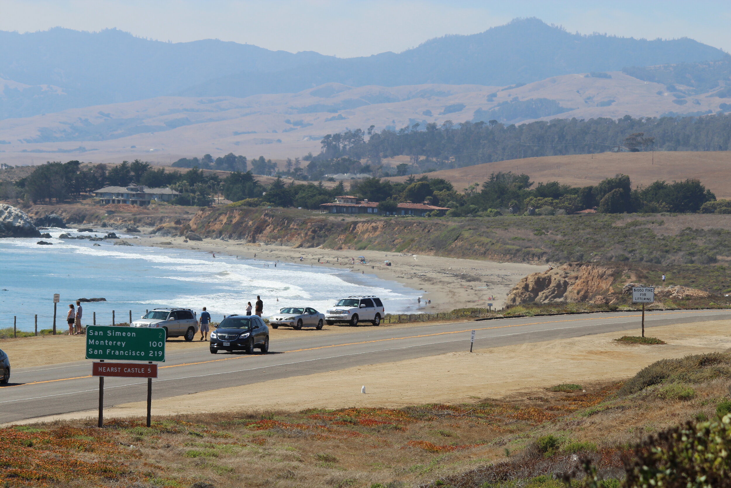
You can still see vestiges of what highways looked like in the middle of the 20th century. If you drive down Highway 99 in California, you can cruise along old segments like Golden State Boulevard in the San Joaquin Valley or San Fernando Road south of the Tehachapi Mountains. You can see old U.S. Highway 101 on the Avenue of Giants through the Redwoods or along the coast south of Oceanside.

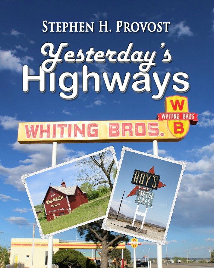
Then, of course, there’s Route 66. Traces of the iconic road from Chicago to Santa Monica are slowly disappearing, but road trips are still on every highway enthusiast’s bucket list. I crossed it off mine in 2019, but I’d gladly do it all over again. The excursion helped form the basis for my book Yesterday’s Highways, a look at the federal highway system founded in 1926: the roads, filling stations, diners, motels and the legacy of our nation’s first official road network.

But what about the roads that came before that?

There’s not nearly as much left of them to find, in part because they were usually dirt or gravel paths— sometimes nothing more than rutted paths through sagebrush carved by narrow tires on Model T’s. (The Old Ridge Route south of Grapevine in California is one example on an early concrete route, which I featured in my book on Highway 99.)

These early roads gave birth to privately funded auto trails. Marked by paint on telephone poles and fence posts, they bore names like the Jefferson and Jackson highways, the Pike’s Peak Ocean to Ocean Highway, the Red Ball Route and the Yellowstone Trail. The most ambitious of these were coast-to-coast projects, intended to give early motorists an alternative to the railroad.

At the turn of the century, most country roads were built for horse-and-buggy outfits intended to travel just a few miles. They took you to or from the train station — and no farther. But as automobiles started to become more common (and more reliable), there was a growing clamor to drive them more than just “into town.” To hit the open road.

In response, a group visionaries, entrepreneurs and opportunists arose to create a chaotic network of trails that crisscrossed the country. Sometimes they shared the same road. Sometimes the road shifted from one route to another — more than once. Sometimes the only road was a line on a map that amounted to wishful thinking and hopes for the future.

America’s First Highways

A friend suggested that I focus on the history of these auto trails in Yesterday’s Highways, but I could tell they deserved a volume all their own. I was surprised to find that no one had written a comprehensive history of this period (at least as far as I could find). There were books about the Jefferson Highway, the Dixie Highway and, especially, multiple volumes on the most famous auto trail: the Lincoln Highway. But I couldn’t find anything that told the whole story: from the people who paved the way for the trails to the creation of the trails themselves and their ultimate demise.

So I decided to write one. The result is America’s First Highways, a companion volume to Yesterday’s Highways and, thus, the second in a series I’ve decided to call America’s Historic Highways.

You’ll read about the first person to drive from coast to coast in an automobile (with a goggle-wearing bulldog) and the around-the-world contest that inspired the movie The Great Race. And about the man who built a road of wooden plants in Southern California across the kind of sand dunes you’d find in the Sahara Desert.

You’ll also find stories of Dwight Eisenhower’s 1919 cross-country trip that helped convince him of the need for an interstate highway system; and the auto camping craze that led to the first motels.

Did you know Henry Ford once set the land speed record ... on a frozen lake? Or that the National Football League was founded in an auto dealership? Or that the man behind the Lincoln Highway built the Indianapolis Motor Speedway and made Miami Beach a winter resort?

I uncovered stories like these. Then, I scoured the internet for historic photos in the public domain, retrieved few pictures from my own cross-country journeys and took a few more for good measure. Then I contacted the Boca Raton Historical Society & Museum for permission to use a classic photo of a camel-shaped highway arch, and the University of Michigan Library, which graciously granted me permission to use a number of Lincoln Highway photos from the Transportation History Collection in its Special Collections Research Center.

The result is a volume packed with details and more than 200 historic and modern images. It’s my fourth book on the nation’s highways and my 30th book overall, and I’m pleased to present it for sale at Amazon.com and look forward to displaying it at fairs and book shows here on the East Coast in the coming year.

What’s next? My book on U.S. Highway 101 is due out May 19, and I’ve already got an idea for another highway-themed book. It’s in the conceptual stage now, but stay tuned for details in the coming months.

Highway author's top 10 road trips (plus 2)

Stephen H. Provost

I’ve spent bits and pieces of the past few years traveling around the country on various highways, and now, here I am, confined to quarters by the coronavirus outbreak. Fortunately, I’ve got my memories and a few photos to keep me company, so I thought I’d share a few of those with you in the form of my favorite stretches of highway ... so far. (I’ve still got a lot of road trips ahead of me, once this thing lifts.)

So far, I’ve produced three highway books: on Highway 99 and Highway 101 in California, and a tome called Yesterday’s Highways about the federal highway system founded in 1926. Next up: America’s First Highways, a look at America’s auto trails, the privately run hodgepodge of half-built highways that crisscrossed the country in the early days of the automobile.

So, without further ado, here are my top 10 stretches of highway, in reverse order, and certainly subject to change once I’m back on the road again.

12. Old Plank Road, California

IMG_5252.JPG

This isn’t exactly a trip on a highway, it’s more a trip to a highway. The Old Plank Road is a stop along Interstate 8 in Imperial County, Southern California, heading east toward Arizona. There’s not much left of it today, but you can still see some of the original wood planks from the roadway, as well as a reconstruction of what it once looked like, The wooden road was built in 1915 to help cars traverse the shifting sands of the Algodones Dunes, then rebuilt a year later. There’s a fascinating story behind it all, including a road race to establish the best route for the road, which you’ll find in Highway 99: The History of California’s Main Street, as well as in America’s First Highways.

11. National Old Trails Road, California

US66-Amboy25.jpg

This stretch of highway was known as Route 66 for four decades, and there are still highway shield signs stenciled into the road along the way, but these days, street signs (and Google Maps) call it the National Trails Highway. It’s a variation on its earlier name, the National Old Trails Road — a series of “old trails” pieced together to provide a way across the continent. Some were little more than rutted wagon-wheel paths, and there’s that same feeling of loneliness to this stretch of highway that there must have been back then. It almost feels like you’re driving on the moon, until you come to an old, abandoned filling station or Roy’s Motel and Café (pictured above), which is still open in the otherwise abandoned hamlet of Amboy. It was 114 degrees when I was passing through on this section of road in a car without air conditioning. Needless to say, I bought a lot of water at Roy’s. You’ll find more about this trip in Yesterday’s Highways.

10. Lincoln Highway, Pennsylvania

LH-GettysburgMemorial8.JPG

I got a chance to explore this section of what’s now called U.S. 30 but started out as the Lincoln Highway, the early 20th century’s most ambitious cross-country route. Planned by Carl Fisher, the same man who built the Indianapolis Motor Speedway and transformed Miami Beach from a backwater hamlet into a booming resort, the Lincoln Highway ran from New York to San Francisco. There’s a lot to see on many sections of the road, but Pennsylvania was my favorite. You’ll pass through historic Gettysburg — and past the site of the historic battle (pictured above) — and you’ll cross one of the most impressive Columbia-Wrightsville Bridge. When it was dedicated in 1930, it was the world’s longest multiple-arch concrete bridge, and the fifth built at that location. The old Lincoln Highway will also take you past Latrobe, childhood home of Arnold Palmer and Fred Rogers, and birthplace of pro football and the banana split. But the highlight for me was the beautiful Allegheny Mountains, rolling hills that find the perfect balance between repose and majesty. For more on the Lincoln Highway, check out Yesterday’s Highways and my forthcoming book, America’s First Highways.

9. Old Ridge Route, California

IMG_1174.JPG

You can drive some of the way along the first highway to span the Tehachapi Mountains, linking Northern and Southern California, although part of it’s blocked off by the U.S. Forest Service. What you can see is fascinating. When it was established back in 1915, a number of local businesses set up shop along this narrow, winding path at the top of the world. Most of them abandoned it when an alternate route went in at a lower elevation to the west in the early 1930s, and only a very few remnants of that first era remain visible. Still, you can imagine what it must have been like to drive along the concrete road at 15 mph (the speed limit) and hope you didn’t run into a truck coming the other way around Dead Man’s Curve, which you can still see from above if you take a detour through Lebec. You can travel portions of the 1930s-era alternate route, too, although it was eventually bypassed itself by Interstate 5. Part of it’s down at the bottom of manmade Pyramid Lake. For more details on the Old Ridge Route, check out Highway 99: The History of California’s Main Street.

8. Highway 101, San DIego County

IMG_3272.JPG

If you want a look at what the first federal highway system was like, before the age of the interstates, this section of highway is a great example. Sure, you can continue down Interstate 5 if you’re traveling from L.A. to San Diego, but why not take your time and drive south from Oceanside through, Carlsbad, Encinitas and Del Mar on a section of road that’s still signed as U.S. 101. The 10-mile Oceanside-Carlsbad Freeway at the north end of the route was started in 1950 to improve the flow of traffic and was the first modern highway in the San Diego area. Still, it passes directly through both cities’ downtown area and, farther south, offers beautiful views of the ocean. The section through Del Mar and past the historic racetrack/fairgrounds is gorgeous, and you’ll pass iconic businesses like the 1928 La Paloma Theatre in Encinitas and the 101 Café (pictured above), built that same year in Oceanside. The latter is worth a stop to check out the cool ’50s-throwback mural on the side of the building. More: Highway 101: The History of El Camino Real.

7. Blue Ridge Parkway, Virginia

IMG-1427.jpg

This 469-mile parkway through Virginia and North Carolina runs along the spine of the Blue Ridge Mountains. Most of what you’ll see is natural beauty, and boy, is there a lot of it. Green rolling hills, scenic overlooks, trees and wildflowers abound. Mountain ridges hug rolling meadows on this scenic drive. There’s aren’t many historic buildings along the way, but it’s worth stopping to check out Mabry Mill (pictured above), a site that features a sawmill, blacksmith shop and other buildings that date from the early 1900s. I haven’t driven the North Carolina section of this road yet, but I suspect it’s every bit as beautiful.

6. Highway 99, Dunsmuir, California

IMG_2272.JPG

The town of Dunsmuir is a hidden gem, where you’ll find some of the cleanest water around. The old alignment of former U.S. Highway 99 takes down of Interstate 5 as you head north into town along Dunsmuir Avenue and past the historic California Theatre, which dates back to 1926. We stayed outside town at the Cave Springs Resort, a historic auto camp with cabins that date back to 1923 but that’s still running as a motel today. Railroad Park Resort, just south of Dunsmuir, offers lodging and eats inside refurbished railroad cars. Also south of town, you can check out the wild rock formations known as Castle Crags, which live up to their name. And the pine trees? They’re all around! More: Highway 99: The History of California’s Main Street.

5. U.S. 11 / Lee Highway, Virginia

IMG-8004.jpg

This section of highway follows the course of an early cross-country auto trail called the Lee Highway, named for Confederate Gen. Robert E. Lee. But west of Wytheville, it doesn’t seem much like a highway at all. Long since bypassed by Interstate 81 just to the north, it’s one of the most enchanting two-lane country roads you’ll find. Out of the blue, you’ll pass an old drive-in theater like the Hiland in the aptly named Rural Retreat. It opened in 1952 and is still operating today. Or you’ll find yourself passing the 1832 Old Stone Tavern in Atkins, that dates back to the time when the highway was a stagecoach route. There’s another historic theater in Abingdon, the Moonlite, which opened in 1949 and was placed on the National Register of Historic Places in 2007. Unfortunately, it closed six years later. Abingdon itself is a treasure trove of history, featuring an old theater, an 18th century tavern (foreground above), a grand 19th century women’s college and much more. This highway would make the list for Abingdon alone. More: America’s First Highways.

4. Pacific Coast Highway, California

IMG_7162.JPG

It’s hard to pick a specific section of this highway, which is routinely rated as the nation’s most picturesque. The section through Malibu is plenty interesting, too. But this segment, which features Big Sur, the iconic Bixby Creek Bridge, an elephant seal rookery, and the ever-intriguing Hearst Castle (with zebras grazing by the side of the road!), is everyone’s favorite. I lived a couple of miles away from State Route 1, as it’s technically known, for about six years, so I got spoiled. While working as a journalist, I even covered the road’s reconstruction after a couple of big mudslides washed sections of it into the ocean. The road north of San Simeon is full of curves and hairpin turns that offer breathtaking views of the ocean. It will take you a lot longer to get up the coast than it will if you travel the inland route (U.S. 101), but the scenery you’ll see is worth the extra time. More: Highway 101: The History of El Camino Real.

3. Route 66, Desert Southwest

US66-MoriartyNM14.JPG

It’s about 500 miles from Glenrio, Texas to Winslow, Ariz., and you can make the trip in about a day. If you don’t stop. But you’ll want to stop many times along the way to check out what’s left the heart of Route 66. Glenrio’s a ghost town at the Texas-New Mexico state line, where you can find dozens of abandoned businesses: motels, diners and homes. It was an entire town, but virtually no one lives there now that Interstate 40 made Route 66 an afterthought – except to nostalgia buffs. Just a few miles west in Tucumcari, you’ll find plenty of old motels and service stations, some of them refurbished and plastered with colorful murals. The highlight here: the still operating Blue Swallow motel, with its distinctive neon sign, that opened in 1940. You’ll see plenty of other old Route 66 businesses along this stretch of highway, including several of the now-abandoned Whiting Bros. service stations that once dominated this section of road. The chain was once based in Holbrooke, and just west, in Winslow, you’ll find a statue inspired by the Eagles’ song Take It Easy, with its reference to “standin’ on the corner in Winslow, Arizona.” More: Yesterday’s Highways.

2. Redwood Highway, California

IMG_1242.JPG

There’s simply nothing like the 140-mile section of U.S. 101 through Northern California known as the Redwood Highway. Starting at the south end of this segment in Ukiah, you’ll pass by the historic art deco Regal Ukiah Stadium 6 cinema, built in 1948, and the World’s Largest Redwood Tree Filling Station, carved out of a tree felled in 1936, when the station started pumping gas. Then, in Willits, you’ll pass beneath the distinctive neon arch. But the real attractions are the trees themselves, which line a section of the older U.S. 101 (now State Route 254) called the Avenue of the Giants. It parallels the current 101 from Phillipsville north to just short of Stafford. Before you get there, stop at the Benbow Inn in Garberville which dates back to the 1920s and offers some high-class atmosphere and the best hamburger you’ve ever eaten. Trust me. Other stops along the way include the drive-through Chandelier Tree and Confusion Hill, a 1949 tourist stop in Piercy. There’s too much to mention here, but there’s plenty in my book Highway 101. More: Highway 101: The History of El Camino Real.

1. Road to Hana, Maui

IMG-2800.jpg

This will always be my favorite. I’ve driven it three times, at three different times of my life, and it never fails to disappoint. Yes, you have to make your way carefully over nearly four-dozen one-lane bridges and around more than 600 curves, but that’s part of the road’s charm. It will take you four hours to get to Hana, which might take you an hour if you could take a straight shot. The thing is, you can’t. Besides, Hana Highway is about the best evidence ever that it’s about the journey, not the destination. There’s not really much in Hana, a sleepy town of barely 1,200 people, but along the way you’ll pass through the nation’s only true rain forest. Along the way are gorgeous seasonal waterfalls, eye-popping ocean overlooks, bamboo forests, black sand beaches and lava tubes. Plus, it’s just fun to drive. It’s almost like a roller-coaster: Merchants even sell T-shirts that proclaim you’ve driven the Road to Hana. This one should be on everyone’s bucket list. (For a bonus trip, drive up the crater road to Haleakala, Maui’s extinct volcano. You’ll view the island and surrounding ocean from above the clouds. But take a jacket. It’s cold up there!)

All photos © Stephen H. Provost, 2015-2020