Contact Us

Use the form on the right to contact us.

You can edit the text in this area, and change where the contact form on the right submits to, by entering edit mode using the modes on the bottom right. 

PO Box 3201
Martinsville, VA 24115
United States

Stephen H. Provost is an author of paranormal adventures and historical non-fiction. “Memortality” is his debut novel on Pace Press, set for release Feb. 1, 2017.

An editor and columnist with more than 30 years of experience as a journalist, he has written on subjects as diverse as history, religion, politics and language and has served as an editor for fiction and non-fiction projects. His book “Fresno Growing Up,” a history of Fresno, California, during the postwar years, is available on Craven Street Books. His next non-fiction work, “Highway 99: The History of California’s Main Street,” is scheduled for release in June.

For the past two years, the editor has served as managing editor for an award-winning weekly, The Cambrian, and is also a columnist for The Tribune in San Luis Obispo.

He lives on the California coast with his wife, stepson and cats Tyrion Fluffybutt and Allie Twinkletail.

at Petunia's b 11-25-17.jpg

On Writing

Filtering by Tag: highway history

Book traces rich history along the ‘Highways of the South’

Stephen H. Provost

To travel the highways of the South is to travel through history, as you pass dinosaur statues and giant chickens; Lucky Strike smokestacks and “come to Jesus” billboards; Waffle Houses and Muffler men. You can even sleep in a wigwam or see seven states from Lookout Mountain.

Read More

Recommended reading for highway history buffs

Stephen H. Provost

I’ve been researching America’s highways for nearly four years now, traveling more than 10,000 miles in my search for history.

When I’m not on the road, I spend hours combing through newspaper files, online articles and books for sources for the most interesting stories.

Many of the books published on historic highways — especially Route 66 — are travel guides, but a few offer extensive information on the history behind the roads, and those are the ones I’m spotlighting here. Titles are arranged alphabetically.

America's First Highways.jpg

America’s First Highways

Stephen H. Provost

Dragon Crown Books, 2020

Paperback, 290 pages, 8 x 10 inches

I set out to write this book after discovering I couldn’t find a single volume that examined the auto trails movement as a whole. There were a few books (some of which are on this list) that focused on individual trails, but I came up empty looking for any comprehensive work on these privately funded roads that preceded the federal highway system.

My research took several turns and resulted in two-part story. Part One looks at what led up to the trails: 18th-century stagecoach routes, the railroads, the Good Roads movement and early automakers. Part Two examines the trails themselves, with full chapters on the Lincoln and Dixie highways, along with extensive sections on the Jefferson and Lee highways, the Yellowstone and Ozark trails, among others.

There are stories of the “great race” from Paris to New York, the old plank road east of San Diego, Dwight Eisenhower’s Army trek over the Lincoln Highway and the auto camps that lined the early roads.

America’s First Highways includes more than 200 photos, some by the author but many vintage images from university and government archives. Pick this one up for a detailed and enjoyable overview of the auto trails phenomenon. It’s the second installment in my America’s Historic Highways series, a companion to Yesterday’s Highways (see below).

American Highway.jpg

The American Highway

William Kaszynski

McFarland & Company, 2000

Hardcover or paperback, 237 pages, 8 x 11 inches

A very good overview with lots of black-and-white illustrations, Kaszynski’s book is divided chronologically, with sections covering “The Early Days” (1900-1919), “The First Generation” (1920-1945), “The Golden Age” (1946-1969) and “The Interstate Era” (1970-2000). There’s a good, though short, section on auto trails that follows a brief overview covering the history of roads.

Another plus: Each of several major gasoline chains and roadside eateries gets its own short section, and there’s a good section on motels, too. The photo captions are sometimes a bit long, but they pack in some good information that augments what’s in the text.

The paperback is $39.95, but it’s also available for less on the secondary market, where you can find it in hardcover.

car culture.JPG

The Big Book of Car Culture

Jim Hinckley and Jon G. Robinson

Motorbooks, 2005

Paperback, 320 pages, 8 x 11 inches

This is a glossy-paged book packed with photos and brief articles on a variety of subjects arranged in six sections:

  • Only Twenty Miles to ...

  • Safety, Comfort and Style

  • The Ride

  • The Culture of the Road

  • Gasoline Alley

  • The Open Road

This isn’t the book to get if you want a comprehensive look at any aspect of the highway, but if you want a grab bag of diverse topics ranging from gas pumps to license plates, from the Lincoln Tunnel to the Las Vegas Strip, this is a breezy, fun read. None of the articles is particularly long, and most don’t go into much depth, but there are lots of illustrations — with color throughout — fun bits of trivia on the expected and the unexpected alike.

Dixie.JPG

Dixie Highway: Road Building and the Making of the Modern South, 1900-1930

Tammy Ingram

University of North Carolina Press, 2014

Hardcover, paperback or ebook; 272 pages, 6 x 9 inches

This very readable, yet information-packed book is divided into five chapters:

  • Building a Good Roads Movement, 1900-1913

  • The Road to Dixie, 1914-1916

  • Roads at War, 1917-1919

  • Modern Highways and Chain Gang Labor, 1919-1924

  • Paved with Politics: Business and Bureaucracy in Georgia, 1924-1927

Of them, I found the first two chapters the most fascinating, and the final chapter the least so. Of particular interest to me was information on how the highway routes were chosen, Carl Fisher’s role and the fights among various towns for a place on the highway. The sorry state of roads in the South, along with the role of World War I and chain-gang labor in improving Southern highways are also examined.

The research is thorough and the writer’s tone is conversational. The text is illustrated by a few photos, old advertisements and postcards. Several maps are also included — and particularly useful.

This is probably the definitive work on the Dixie Highway, a road that doesn’t get nearly as much attention as it deserves for the role it played in developing our highway system — and our nation.

Gas Station.JPG

Gas, Food, Lodging

This trilogy by John A. Jakle and Keith A. Sculle examines, in turn, service stations, roadside eateries and motels/inns. If you’re interested in American road culture, I challenge you to find more information in one place on any of these subjects.  

The three I’ve read in the authors’ Gas, Food, Lodging series have all been excellent, and I can recommend all three. They’re a little more academic than some books out there, which makes sense because the authors are both professors: Jakle specializes in geography and landscape architecture at the University of Illinois at Urbana-Champaign, while Sculle teaches history at the University of Illinois at Sprinfield. Each volume is packed with more information on chains and trends, along with statistical information, than you’ll find most places:

The Gas Station in America

Johns Hopkins University Press, 1994

Hardcover or paperback, 288 pages, 7 x 9.5 inches

The Motel in America

Johns Hopkins University Press, 1996

Hardcover or paperback, 408 pages, 7.5 x 10.5 inches

Fast Food: Roadside Restaurants in the Automobile Age

Johns Hopkins University Press, 1999

Hardcover or paperback, 416 pages, 7 x 11 inches

Highway 99.jpg

Highway 99: The History of California’s Main Street

Stephen H. Provost

Craven Street Books, 2017

Paperback or ebook, 233 pages, 8.5 x 10 inches

I set out to write the definitive history of U.S. Highway 99 in California and drove the length of the road, from the Mexican border to Yreka, taking photos, doing interviews and collecting information. I grew up along the highway, riding with my parents from Fresno to Orange County and back again several times a year and I wanted to preserve some of the memories I had — and find out more about California’s north-south version of Route 66.

I walked the cracked concrete on the Old Ridge Route between Bakersfield and L.A. I hiked out to the ruins of San Francisquito Dam. I drove Golden State Boulevard and San Fernando Road, old alignments of the modern highway.

I researched scores of news articles, books and other sources to create a three-dimensional portrait of the highway in two parts. The first tells the story of the road’s history, complete with the disasters that altered the shape of the road and the Dust Bowl migrants who traveled it. Gas stations, coffee shops and motels get full chapters. Then, the second part provides a tour of the highway, from south to north, stopping briefly in each town along the way.

The first book in the California’s Historic Highways series, this glossy-paged tome includes a section of color photos by the author. The text throughout is illustrated by historical and modern images.

Hwy101cover.jpg

Highway 101: The History of El Camino Real

Stephen H. Provost

Craven Street Books, 2020

Paperback or ebook, 270 pages, 9 x 10 inches

The second book in the California’s Historic Highways series follows much the same format as Highway 99. Part I tells the story of Highway 101 in California, from its origins as a wagon road connecting the Spanish missions to its new era as a federal highway. Part II offers the reader a literary road trip with stops along the coast in Carlsbad, at the Hollywood Bowl in Los Angeles, the eclectic and eccentric Madonna Inn in San Luis Obispo, the Golden Gate Bridge and the majestic redwood along the Avenue of the Giants.

There’s even a section about the Pacific Coast Highway, State Route 1, which parallels and sometimes joins 101 as it meanders up the coast. You’ll find out about “muffler men,” Disneyland and the short-lived Pacific Ocean Park marine amusement park in Santa Monica. You’ll learn about the fancy gas station that was targeted in the only Japanese strike to hit the U.S. mainland during World War II.

Like Highway 99, this companion volume comes complete with a central color well of vibrant photos from the author himself (yeah, that’s me).

Capture.JPG

Highway History

Richard F. Weingroff

U.S. Department of Transportation, Federal Highway Administration — fhwa.dot.gov

Online

This isn’t a book, but it might as well be. In fact, there’s probably enough material here for several books, and the best part is, it’s free.

Richard F. Weingroff has written numerous articles about highway history, all of which are available for viewing on the site. Weingroff is information liaison specialist for the FHA/DOT and became the agency’s “unofficial  historian” in the 1980s. He’s written articles on the Jefferson Highway, the Lincoln Highway, and several other auto trails; the interstate highway system; President Eisenhower’s role in improving the nation’s highways, and dozens of other topics.

Jefferson.JPG

The Jefferson Highway: Blazing the Way from Winnipeg to New Orleans

Lyell D. Henry Jr.

University of Iowa Press, 2016

Paperback or ebook, 220 pages, 6 x 9 inches

Henry’s book is to the Jefferson Highway what Ingram’s work is to the Dixie, with a heavier dose of historical photos, which is welcome. Did you know the guy behind this particular road was also the publisher of Better Homes & Gardens? Or that the Jefferson Highway was born in Iowa? You may never have heard of the highway at all, and if you haven’t, you’ll find a host of interesting information in Henry’s book.

The author is a professor of political science, but he writes in a conversational and easy-to-read style. The third and fourth chapters, which cover how the highway was built and marked (with signs) contained the most interesting info, at least to me, with the latter chronicling the decline and eventual fall of the road as numbered federal highways took its place.

The book is divided into two parts. The first five chapters delve into the history of the highway, which, for the uninitiated, ran from Winnipeg up in Manitoba, Canada, down to New Orleans. The last three chapters focus on “Looking for the Highway,” which is great if you want to take a tour. The section also includes photos of notable roadside sites and sights.

Ridge Route.JPG

Ridge Route: The Road that United California

Harrison Irving Scott

Independently published, 2015 (updated edition)

Hardcover, 410 pages, 6 x 9 inches

This book was a labor of love, and it shows. Scott has devoted decades to preserving the concrete pavement across the Tehachapi Mountains that first united Northern and Southern California, starting in 1915. The Old Ridge Route is a relatively short road (compared to, say, Route 66) that served motorists for a brief period of time — it was bypassed less than two decades after the first concrete pavement was laid down. Is there enough information on such a road to fill an entire book? Rest assured, there is, and Scott does a great job of covering all the bases.

Scott says in his preface that eight years of research went into this book, and it shows. A full 25 chapters cover everything from road construction to roadside inns, with sections on the tragic yet intriguing Saint Francis Dam disaster and a crazy winter snowstorm in 1922.

At $39.95, this book is a bit pricier than some, but its glossy pages and plethora of fine historical photos make it worth the investment for any highway buff.

66.jpg

Route 66: The Highway and Its People

Susan Croce Kelly (text) and Quinta Scott (photos)

University of Oklahoma Press, 1988

Hardcover or paperback, 210 pages, 9 x 10.5 inches

This is a hybrid book, featuring lots of great photos and plenty of illuminating text. It includes some great historical background on the formation of Route 66, along with interviews with many who lived along the road — a perspective you don’t find in most books of this type. Chapters focus on how the road was conceived and paved, and the impact of the Dust Bowl and World War II, among other subjects.

The main text is sprinkled with photos, but there’s also a 61-page glossy section at the heart of the book that’s just photos. They’re all in black and white, which adds to the nostalgic, wistful and sometimes almost ghostly feel of a highway that’s disappearing, piece by piece. There are scores, perhaps even hundreds of books out there on Route 66. If you have to choose just one, get this one.

Ribbon.JPG

That Ribbon of Highway

Jill Livingston (text) and Kathryn Golden Maloof (photos)

Living Gold Press, 2010

Paperback in three volumes, 288, 288 and 252 pages, 8 x 6 inches

A solid overview of Highway 99 in three volumes, this series offers plenty of photos and some interesting facts, presented in brief sections that are similar to what you’ll find on the Living Gold Press website (which is, incidentally, a great resource on highway history that goes far beyond U.S. 99, with sections on such diverse topics as Woody Guthrie and Dorothea Lange, Giant Oranges and water towers).

These books include a nice selection of photos and graphics, which reproduce well, and the short sections make for easily digestible reading, almost like a trivia book. The illustrations are also strong and helpful. The shape of the book itself is a little odd — it 8 inches horizontal by 6 inches vertical — which takes some getting used to for those accustomed to more standard formats, but on the plus side, makes it easy to pack if you’re going on a road trip.

Yesterday's Highways.jpg

Yesterday’s Highways

Stephen H. Provost

Dragon Crown Books, 2020

Paperback, 264 pages, 8 x 10 inches

This book was an outgrowth of a 2019 road trip along Route 66, Lincoln Highway (mostly U.S. 30), and several other highways across the country. I envisioned this project as a photo book and took hundreds of photos with that as my goal. After I got back and started researching those photos, however, I found so much information that I decided to expand my mission to create a book with plenty of historical info, as well.

This book doesn’t stop at the edge of the highway, but focuses on the landmarks by the side of the road, delving into the history of service stations, motels, eateries and roadside attractions. Sections on the old Whiting Bros. gas chain along Route 66, White Castle, Howard Johnson’s, the Valentine diners and the Pig Stand are among the bits of information you’ll find here.

This isn’t a travel guide, but anyone who wants a preview of what you’ll see on a trip down Route 66 or the Lincoln Highway will find this book interesting. I chose to focus on those two highways more than any others because, taken together, they represent the best — and most iconic — U.S. highways from the golden age of the American road.

Dixie dilemma: Old highway names and slavery’s stain

Stephen H. Provost

It was easy when I lived in California. I wrote books about highways marked by straightforward numbers (Highway 99 and Highway 101). No controversy there. They had names, too, but “El Camino Real,” “Golden State Boulevard” and “The Hollywood Freeway” are pretty benign.

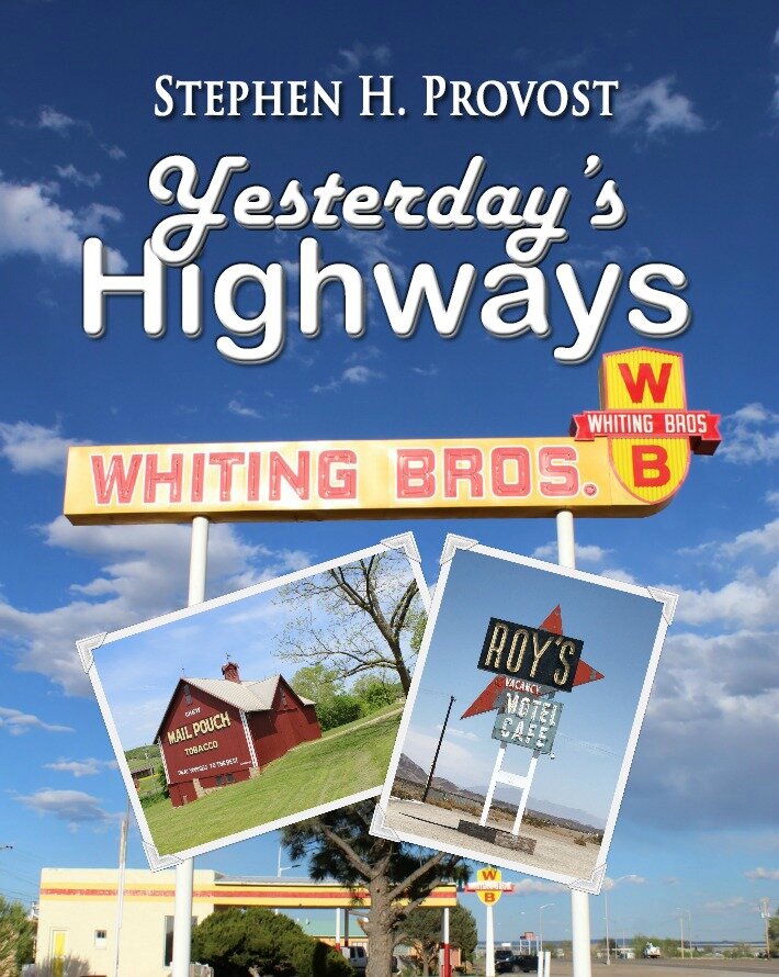
Then, I moved to the South, and I wanted to keep writing about highways. My first offering, Yesterday’s Highways, dealt mostly with numbered roads on the federal highway system, like Route 66. But before those roads had numbers, they had names. Nothing else, just names.

They were called auto trails, privately funded highways that were part gravel, part pavement and part dirt that crisscrossed the country in the early years of the 20th century. They’re the subject of my forthcoming work, America’s First Highways.

The highway builders promoted them by naming them for larger-than-life figures like Lincoln and Roosevelt, Jackson and Jefferson. Or for geography, adopting names like Yellowstone and Pikes Peak.

In the South, however, highway builders paid tribute to figures like Jefferson Davis and Robert E. Lee, “heroes” of the Confederacy. I put “heroes” in quotes, because I can’t fathom ever applying such a term to men who fought a bloody war for a system of government that brutally enslaved human beings.

When I shot the cover art for my book Martinsville Memories, depicting this Southern town’s historic courthouse, I purposely excluded the Confederate monument on the front lawn. As I’ve written in the past, I don’t believe the Confederacy should be celebrated.

Yet I did want to celebrate the auto trails that bore the names of these men. The question was how to do so without celebrating the men themselves. For one thing, I view the monuments alongside these roads more as tributes to the roads’ builders than to slavery. 

Carl Fisher, a man who built the Indianapolis Motor Speedway and developed Miami Beach, would have been an impressive figure even if he hadn’t started the two most significant auto trails: the Lincoln and Dixie highways. The names would seem an interesting contrast. The first, running east to west was named for “The Great Emancipator,” while the second, oriented north and south, bore a name many associate with the Confederacy.

“Dixie” was, after all, the title of the most famous Confederate anthem, often performed my minstrels in blackface. Yet Lincoln himself deemed it “one of the best tunes” he’d ever heard, and the term “Dixie” started off as a geographical reference to the Mason-Dixon Line separating Pennsylvania and Maryland. Many today still view it in purely geographic terms, and Fisher’s group saw their Dixie Highway as a bridge to  tie the nation back together after the Civil War.

Not that Fisher himself was a saint, by any means. He was sometimes a drunk who, at the age of 35, ditched his fiancée of nine years to marry a 15-year-old girl. And his main purpose in building the road was to give northerners a way to reach his resorts in Miami Beach. It was, for him, a money-making proposition.

When writing about these old roads, it’s impossible to simply ignore their names — even though many conveniently ignore that the Jefferson Highway’s namesake was a slaveholder, too. (A visit to Monticello, Thomas Jefferson’s estate, can be an eye-opener for its tour of the slave quarters and is highly recommended.)

I’m happy that the Jefferson Davis Highway has been renamed the Richmond Highway through part of Virginia, and it’s fine with me that a portion of the Dixie Highway through Florida is now named for Barack Obama. Another president’s name on an old auto trail is a perfect fit. Plus, I have to say I enjoy the fact that it must have galled Lee Highway boosters that their road passed by a historic African-American church in Marion, Va.

But history is seldom simple. I don’t believe the names of these roads should obscure their importance to the development of our nation’s road system. Nor do I believe that huge turning point in our history should overlook the fact that highways in the South were often built by chain gangs of inmates — most of whom were black and many of whom were unjustly imprisoned.

History should shine a light on virtuous and vile deeds alike, so we can know how to replicate the former and avoid repeating the latter.

That’s what I hope my writing does. It can be a difficult line to walk, but it’s always a worthy goal, and one I intend to keep pursuing.

Photo: An exit for U.S. Highway 11, aka the Lee Highway, in western Virginia (author photo)

Highway 99, the Lost Chapter: Trucks and Truck Stops

Stephen H. Provost

NOTE: this chapter has been reworked slightly and is now included in my book Yesterday’s Highways, available on Amazon.

Sometimes, you can't squeeze everything in. You've done your research and you've found a lot of interesting stuff - too much, in fact, to fit in the pages of the book you're writing. So, something has to go. 

Highway 99: The History of California's Main Street originally included a few sections that ultimately failed to make the cut. I had to leave out an entire chapter on big rigs and truck stops that I'd intended to include, but which wound up being sacrificed when the manuscript wound up being longer than I'd intended. So here it is, the "lost" chapter, presented here for the first time with the photos I originally chose to illustrate it. Enjoy!

(If you like what you read here, Highway 99 is available for purchase on Amazon or through the publisher at quilldriverbooks.com)

A big rig passes an old motel sign at Desert Shores along the former U.S. 99, now State Route 86, at the western edge of the Salton Sea. © Stephen H. Provost, 2014.

A big rig passes an old motel sign at Desert Shores along the former U.S. 99, now State Route 86, at the western edge of the Salton Sea. © Stephen H. Provost, 2014.

More Than Four Wheels

You can’t get too far on the highway before seeing a “Divided Highway” sign. In some places, 99 is divided by a center median, often landscaped with oleanders or other shrubs. But there’s one kind of division you’ll find on the highway no matter which stretch you’re traveling: the division between vehicles with four wheels and those with 18 (give or take a few).

It’s hard to miss the big rigs, buses, tractor-trailers and the like that are so common on the highway. For years, 99 has served as the economic backbone of the state, passing through fertile farmland and industrial centers alike. Warehouses, grain silos and distribution centers line the highway. In the days of the federal highway system, it didn’t matter whether you were transporting raisins from Selma or dates from Indio: U.S. 99 was the way to go.

Still, even today, if you’re behind the wheel of a Mercedes or a Mazda, you might not pay much attention to the infrastructure built around the trucking industry. The average motorist might cross the Tehachapis without taking much notice of signs with messages such as “6% grade 2½ miles ahead” and “Trucks use low gears.” Trucks are supposed to observe a lower speed limit and keep to the right, so swifter automobiles can pass. Runaway truck ramps, with their heavy gravel to slow down out-of-control big rigs, are visible on the downslope from Lebec heading north toward Grapevine. You’ll see the first one on your right, a little more than three miles north of Tejon Summit, and the second on your left less than a half-mile later.

In the highway’s early days, without such precautions, accidents were far too common and, often, tragic. The original Ridge Route had more than its share of hairpin turns hugging steep cliff walls; a single mistake, even at 15 miles per hour, could be catastrophic, and the white picket fences that served as guardrails around dangerous turns were hardly sturdy enough to keep heavy truck from lurching over the edge. The 180-degree hairpin called Deadman’s Curve between Lebec and Grapevine was particularly treacherous.

Once the Ridge Route Alternate was built, the straighter highway reduced the danger of missing a turn but raised a new threat: The straighter road meant trucks could build up a head of speed going downhill that made them even more dangerous if their brakes started smoking and failed unexpectedly.

In 1946, The Bakersfield Californian detailed a truck’s “mad plunge” just before midnight one July evening. It went out of control and sideswiped a passenger car, sending it off the highway and leaving the driver shaken but uninjured. The truck careened on toward Grapevine, where it slammed into the rear of a van, propelling it into a row of gasoline pumps and three other cars at the Richfield filling station. The truck, meanwhile, kept going, plowing into yet another car and shoving it to the edge of the embankment, where both vehicles burst into flames. A passenger in the truck was burned to death, its driver suffered a broken leg, and the driver of the final car to be hit was hospitalized with severe burns.

Other news reports told similar stories. Out-of-control trucks became, as one writer put it, “juggernauts of death” on a stretch of highway that was fast becoming known as Bloody 99: the steep grade just south of Grapevine. During one 10-day stretch in 1943, that single section of road bore witness to nine runaway truck accidents.

Engineers added a concrete barrier to keep trucks from swerving into oncoming traffic, and other proposals surfaced as well. One involved requiring trucks to stop at the summit and switch into low gear before descending, though critics argued that this would merely back up traffic and create a new hazard.

The café, garage and 76 station at the bottom of the Grapevine Grade bore witness to numerous crashes, as trucks came barreling down the incline and careened off the roadway. Photo courtesy Ridge Route Communities Historical Society.

The café, garage and 76 station at the bottom of the Grapevine Grade bore witness to numerous crashes, as trucks came barreling down the incline and careened off the roadway. Photo courtesy Ridge Route Communities Historical Society.

The Grapevine Grade wasn’t the only trouble spot. The Five Mile Grade, heading the opposite direction near Castaic, was also the scene of numerous brake failures and truck crashes. A runaway truck ramp, like those above Grapevine, was built in the 1950s to reduce the number of accidents, but it only remained in use until 1970. It was then that a freeway upgrade created a novel alignment: New southbound lanes were added, following a gentler downward slope to the east, while the old southbound route was converted to carry northbound traffic. As a result, drivers traveling over the five-mile stretch between Castaic and Violin Summit progress British-style, on the left of oncoming traffic. (A significant gap separates the two segments of roadway).

The emergency ramps came in handy, not only for truckers, but also for law enforcement. On at least one occasion, one of the ramps Grapevine Grade halted more than a runaway trucker: They stopped an accused runaway kidnapper. In January of 2008, Highway Patrol officers and Los Angeles responded to a report that a man had assaulted his estranged wife and abducted their child, making his escape in a stolen truck. The officers pursued the suspect northbound over more than 70 miles from Highway 101 onto Interstate 5 before the chase finally ended just north of Grapevine. It seems the man mistook one of the runaway truck ramps there for a highway exit and found his vehicle immobilized by the coarse gravel.

He was arrested immediately.

One reason the trucks can be so dangerous on a steep downhill slope is their weight. Big rigs can weigh up to 40 tons, compared to the typical car at only 2½ tons. Once they get going at highway speeds, they can require two-thirds more pavement to stop once the brakes are applied – if the brakes are working. That’s part of the reason California requires trucks rated above a certain weight (currently 11,500 pounds) to stop at scales cleverly designated as “weigh stations.” And it’s no accident that two of the eight or so weigh stations along the historic U.S. 99 route can be found at either side of the Tehachapis, just south of Castaic and slightly north of Grapevine.

The state recognized the need for scales early. In 1938, officials set up a 24-hour truck-checking station at Fort Tejon, near the point where the 99 began the steepest portion of its descent into the San Joaquin Valley. Highway Patrol officers were on hand to make sure loads were within limits defined under state law. “This station,” the California Highways publication declared, “will not only guard against overweight loads, but will also enable the traffic officers to insure that trucks using this mountain route are in good running order, and that all their braking equipment is working properly.”

A small truck scale business operates at the northbound entrance to Highway 99 off Herndon Avenue, north of Fresno. © Stephen H. Provost, 2014.

A small truck scale business operates at the northbound entrance to Highway 99 off Herndon Avenue, north of Fresno. © Stephen H. Provost, 2014.

Private scales operated by companies such as CAT also opened up and down the highway, with nearly two dozen along the old 99 route between Los Angeles and the Oregon border as of 2014. Such private operations help ensure truckers’ loads are below the legal weight limit. CAT, for instance, offered this guarantee on its website: “If a driver receives an overweight fine after weighing legal on a CAT brand scale, CAT Scale Company will either pay the fine or appear in court with the driver as an expert witness in order to get the fine dismissed.”

Scales are far from the only highway business to have emerged in support of the trucking industry. As the nation shifted from the railroad to the highway as its primary means of transporting goods, a new industry sprang up to support the drivers who spent days away from home, driving long hours cross-country. They needed places to spend the night, to clean up, to grab some coffee and get a bite to eat. They also needed a place to buy the kind of fuel their semis ran on, diesel, which wasn’t always available at traditional gas stations.

Truck stops sprang up to fill these needs. Some establishments that catered to travelers and tourists, such as Sandberg’s, refused to serve truck drivers. But other stops along the old Ridge Route and elsewhere offered various combinations of a garage, cheap accommodations and a diner or coffee shop that suited truckers pretty well. As time passed, some roadside establishments started catering specifically to truckers, seating them first at the lunch counter or offering them a place to shower in the back.

When it came to sleeping arrangements, truckers had to make do. During the early years, some stayed at roadside auto camps, and many roughed it by sleeping in their vehicles, whose wooden seats were anything but the epitome of comfort. Anything more elaborate was usually improvised, and not necessarily any more comfortable. One San Joaquin Valley-based company rigged up a couple of ’22 Packards with wooden boxes over the cabs where the relief driver could sleep. The casual observer might have feared an appearance by Dracula at any moment.

By the mid-1930s, however, a few manufacturers had started offering sleepers as part of the package. The wooden boxes gave way to so-called “coffin sleepers,” cramped quarters usually placed directly behind the cab. These compartments might have been 2 feet wide by 3 feet tall, giving the occupant barely enough room to turn over. Drivers with claustrophobic tendencies need not apply.

In the early 1950s, Kenworth offered a CBE model, which stood for “Cab-Beside-Engine.” The CBE design included a sleeping space for the relief driver between the cab and the engine, a configuration that earned it the nickname “suicide sleeper”: Few occupants could expect to survive a crash while they slept right next to the engine.

As trucks gained horsepower and gained load capacity, there was often no longer room for them at the inn. Many early motor courts included carports alongside their cabins, but they were called CARports for a reason: They didn’t provide enough clearance for trucks. Drivers ran into the same problem at some service stations, where canopies built to shield pumps from the elements were often too low to allow larger trucks access.

A mural outside Clark’s Truck Stop in Indio celebrates the history of U.S. 99. © Stephen H. Provost, 2015.

A mural outside Clark’s Truck Stop in Indio celebrates the history of U.S. 99. © Stephen H. Provost, 2015.

Truck stops offered an array of services that establishments catering to the auto traveler did not.

Many of the earliest among them, like the earliest motels and gas stations, were independent operations, but larger companies soon entered the fray once they realized they were missing a large segment of the market. Flying A’s flat-top station in Fresno, with its 110-foot “GAS” tower on the west side of 99, was a prime example of an early truck stop. The canopy was 70 feet high, providing ample room for trucks – which got their own separate entrance. Diesel fuel was available; there was a “completely equipped” truck lube pit, a public scale capable of weighing the largest truck on the road, and free shower rooms for all truckers. The expansive parking lot provided room for truckers to park their rigs and get a few hours’ worth of shuteye.

The station was still there until recently (having been removed to make way for the new high-speed rail line), although it sold Valero gasoline at the end, as does another venerable establishment, Clark’s Travel Center in Indio, offering “everything for the traveler, whether you are an RV’er, trucker, river rat or desert rat.” Amenities include a truck wash, long-term parking, self-service laundry, 24-hour restaurant and car-truck wash. Clark’s, which opened in the 1940s, advertises itself as “the oldest operating truck stop on historic Route 99 from Canada to Mexico.”

Klein’s Truck Stop at Herndon Avenue north of Fresno had a reputation among locals as serving some of the best breakfasts in town. But truckers were the most valued clientele: They were always served first. © Stephen H. Provost, 2014.

Klein’s Truck Stop at Herndon Avenue north of Fresno had a reputation among locals as serving some of the best breakfasts in town. But truckers were the most valued clientele: They were always served first. © Stephen H. Provost, 2014.

The restaurant at Klein’s Truck Stop in the hamlet of Herndon, just north of Fresno, earned a reputation for serving among the best breakfasts around. The restaurant stayed open into the new millennium before finally closing its doors, yielding to a Taco Bell and an am/pm minimart while maintaining a huge parking lot as a place for truckers. One traveler from Los Angeles endorsed it by stating that, no matter how hungry he might be, he always held his appetite in check if he were within 50 miles of Klein’s.

Despite its popularity among the locals, there was no mistaking its target audience: the truck driver traveling the Main Street of California. When a truck driver came in, the hostess would usher him to the head of the line. The waitresses wore beehive hairdos, and each table had its own jukebox, offering up (of course) country music. The cooks made the kind of all-American fare that kept the belly feeling full for hours: hearty portions of chili, barbecue dishes, chicken-fried steak, their famous biscuits and gravy, and “pancakes as big and flat as Fresno.”

As time passed, places like Klein’s were eclipsed by truck palaces called travel plazas or travel centers, giant complexes along 99, I-5 and other major highways that were affiliated with big chains. And as the complexes grew bigger, a funny thing happened: Suddenly, they weren’t just for truckers anymore. Convenience stores served as many travelers as truckers, selling touristy T-shirts and CDs alongside motor oil and citizens band radio accessories.

Flying J, with four locations along the old 99 route, offered such amenities as Subway and Denny’s restaurants, 14 showers, a CAT scale, public laundry, video game arcade and ATMs at its site north of Bakersfield. Pilot, which bought out Flying J and had six locations along the old highway route as of 2014, offered another option, as did Petro Centers (four), Love’s Travel Shops (four) and TA Travel Centers (five).

The Flying J Travel Center at the Frazier Park exit from Interstate 5 is a convenient and popular midway point to gas up and get refreshments between Bakersfield and the San Fernando Valley. © Stephen H. Provost, 2014.

The Flying J Travel Center at the Frazier Park exit from Interstate 5 is a convenient and popular midway point to gas up and get refreshments between Bakersfield and the San Fernando Valley. © Stephen H. Provost, 2014.